Land Surveying students earned 3rd place in national competition
For the second year in a row, Cincinnati State land surveying students traveled to Washington, D.C., in late March to compete in the National Society of Professional Land Surveyors (NSPS) National Student Surveying Competition.
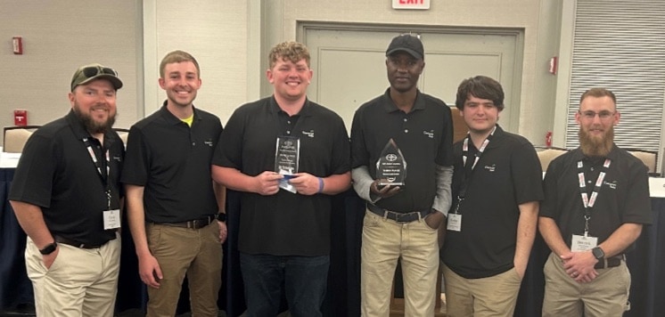
The Cincinnati State team improved on last year’s fourth place finish by taking third place in the 2023 competition against collegiate land surveyors from 25 schools across the U.S.
The team from Ferris State University (Big Rapids, Michigan) finished in first place and California Polytechnic State University (San Luis Obispo) came in second.
Cincinnati State’s 2023 team included a senior from Indiana, and a sophomore and two freshmen from the Cincinnati area. All are members of the Cincinnati State student chapter of the National Society of Professional Surveyors. Their faculty advisor, Land Surveying Program Chair Dr. Carol Morman, also attended the event.
The CState team received support for the trip from several chapters of the Professional Land Surveyors of Ohio (Cincinnati, Miami Valley, and Toledo), the Northern Kentucky chapter of the Kentucky Association of Professional Surveyors, the Indiana Society of Professional Land Surveyors, and Lutz’s Surveying Services (Maineville, Ohio).
The annual competition for young or new-to-the-profession land surveyors is hosted by the Young Surveyors Network, a subset of the NSPS. The event started with a brief introduction dinner and orientation, followed by two full days of competition, and a concluding luncheon and awards ceremony.
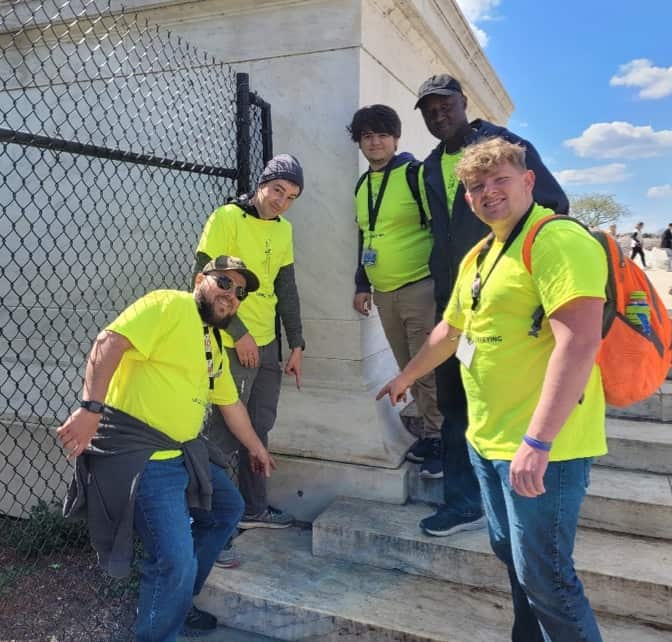
The first day of competition included a six-hour hunt throughout D.C. for survey monuments— the markers used in a survey to represent specific points or geographical coordinates. A liaison from the Young Surveyors Network documented the team’s progress and tracked their event statistics.
The team navigated through the streets of D.C. in search of survey monuments using the D.C. Metro (subway) system, bikes, scooters, and on foot, while referring to a mobile app-based map that was linked to the National Geodetic Survey’s Benchmark Locator.
Teams earned points for finding each monument and taking a photo showing all members at each monument. The monuments that were part of the hunt included the original boundary stones that marked the limits of D.C. as laid out in the 1790’s, as well as markers like tops of flag poles and building turrets used to establish angles for surveying on the streets below.
Over the course of six hours, the CState team traveled approximately 30 miles, locating and documenting a variety of surveying monumentation.
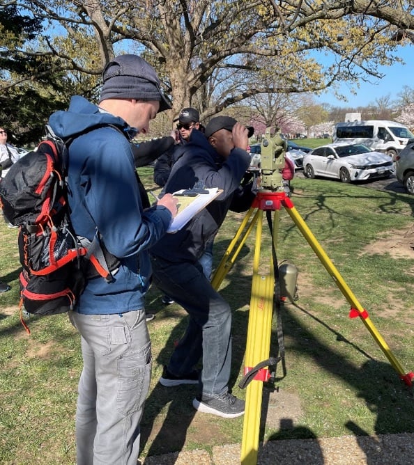
On the second day, students met at the base of the Washington Monument to perform three land surveying challenges: conducting a three-wire level loop near the base of the monument, performing a triangulation exercise to determine coordinates of an unknown point, and working through a traverse laid out on the National Mall.
While these tasks are familiar to professional land surveyors, the student teams were on their own to accomplish each activity.
In addition, the instruments used to perform the challenges were not the tools used in most land surveying classrooms and labs. Instead, students had to use historical equipment including magnetic compasses, T-2 theodolites, and Gunter’s chains.
Employing the older tools gave the students opportunities to expand their understanding and appreciation of historic surveying methods– and added another layer of difficulty to the competition.
The third place finish for Cincinnati State’s team resulted in a new trophy for the display case, as well as a $500 prize, sponsored by survey equipment and software manufacturer Trimble, Inc.
Dr. Morman said the strong finish “provides a confidence boost for the members of the team, and reassurance that the Cincinnati State program is effectively training tomorrow’s land surveyors.”
“Also, the students will forever share memories of an exciting week that included more than the top-three finish,” Carol added. “The real reward of the whole experience was getting to meet and hear directly from the surveying legends of today, and to get plugged in to the forefront of progress in our shared profession.”
Carol said Cincinnati State Land Surveying students and the other members of the Cincinnati NSPS student chapter look forward to continuing the tradition of excellence and proudly representing the College and our region in future National Student Surveying Competitions.
(Reporting and photos provided by Dr. Carol Morman)